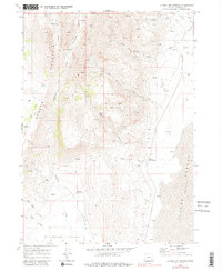
1968 Map of Alvord Hot Springs
USGS Topo · Published 1981About this map
Steens Mountain dominates the western landscape of this high-desert region, where dramatic relief drops toward the Alvord Desert (Depression). The map documents a rugged resource-extraction and ranching frontier in Harney County during the late 1960s, evidenced by a Mine and Tramway located near Dry Creek. Water is the defining constraint of the era, marked by numerous named points like Belzar Spring and the Alvord Hot Springs.
Find a feature on this map
27 named features on this map. Tap any name to fly to it.
Don’t see what you’re looking for? This feature index may not catch every label — zoom into the map to look around manually.
Map Details
Editions of this 1968 Alvord Hot Springs Map
3 editions found
Other maps of this area

1955 · Adel
USGS Topo · 1:250,000

1957 · Adel
USGS Topo · 1:250,000

1958 · Adel
USGS Topo · 1:250,000

1962 · Adel
USGS Topo · 1:250,000

1968 · Fish Lake
USGS Topo · 1:24,000

1968 · Wildhorse Lake
USGS Topo · 1:24,000

1968 · Alvord Hot Springs
USGS Topo · 1:24,000

1968 · Ankle Creek
USGS Topo · 1:24,000

1971 · Andrews
USGS Topo · 1:24,000

1971 · V Lake
USGS Topo · 1:24,000