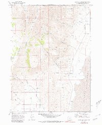
1968 Map of Alvord Hot Springs
USGS Topo · Published 1981About this map
Steens Mountain dominates the western horizon of this high-desert landscape, where steep slopes descend rapidly toward the flat expanse of the Alvord Desert (Depression). The map reveals a transition from the alpine heights to the arid floor of Wildhorse Valley, defined by a network of drainage systems like Little Wildhorse Creek and Pike Creek. Along the edge of the desert floor, Alvord Hot Springs serves as a significant geothermal landmark, while further south lies Belzar Spring. Human activity is primarily centered on mining and water management, evidenced by a Mine, various Prospects, and a Tramway located in the rugged canyons. Water infrastructure is critical here, with the Alvord Flume and an Aqueduct moving water across the thirsty terrain. Isolated Ruins and scattered Jeep Trails suggest the difficulty of navigating and settling this remote corner of Harney County.
Find a feature on this map
29 named features on this map. Tap any name to fly to it.
Don’t see what you’re looking for? This feature index may not catch every label — zoom into the map to look around manually.
Map Details
Editions of this 1968 Alvord Hot Springs Map
3 editions found
Other maps of this area

1955 · Adel
USGS Topo · 1:250,000

1957 · Adel
USGS Topo · 1:250,000

1958 · Adel
USGS Topo · 1:250,000

1962 · Adel
USGS Topo · 1:250,000

1968 · Fish Lake
USGS Topo · 1:24,000

1968 · Wildhorse Lake
USGS Topo · 1:24,000

1968 · Alvord Hot Springs
USGS Topo · 1:24,000

1968 · Ankle Creek
USGS Topo · 1:24,000

1971 · Andrews
USGS Topo · 1:24,000

1971 · V Lake
USGS Topo · 1:24,000