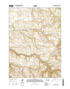
2017 Map of Roaring Springs SE
USGS Topo · Published 2017About this map
Catlow Rim dominates the southwestern corner of this high-desert landscape in Harney County, where the dramatic elevation change defines the transition from the upper plateau down into the basin. The drainage network is the primary characteristic of this territory, featuring the perennial flow of the Donner und Blitzen River in the east and the deeply incised Threemile Canyon to the south. These watercourses, including Threemile Cr and Home Cr, are critical lifelines in an arid environment otherwise marked by ephemeral features like Dry Cr. Human activity is represented by primitive transportation routes such as Lauserica Rd and Lower Crossing Rd, which navigate the township and range lines. The presence of Three Springs further highlights the vital importance of reliable water sources for both local wildlife and any historical ranching operations in this isolated portion of southeastern Oregon.
Find a feature on this map
13 named features on this map. Tap any name to fly to it.
Don’t see what you’re looking for? This feature index may not catch every label — zoom into the map to look around manually.
Map Details
Editions of this 2017 Roaring Springs SE Map
This is the sole edition of this map. No revisions or reprints were ever made.
Other maps of this area

1955 · Adel
USGS Topo · 1:250,000

1957 · Adel
USGS Topo · 1:250,000

1958 · Adel
USGS Topo · 1:250,000

1962 · Adel
USGS Topo · 1:250,000

1967 · Roaring Springs
USGS Topo · 1:24,000

1968 · Tombstone Canyon
USGS Topo · 1:24,000

1968 · Fish Lake
USGS Topo · 1:24,000

1968 · Roaring Springs SE
USGS Topo · 1:24,000

1968 · Ankle Creek
USGS Topo · 1:24,000

1971 · Garrison Lake
USGS Topo · 1:24,000