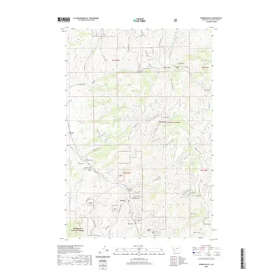
2020 Map of Robbins Gulch
USGS Topo · Published 2020About this map
Bitterroot National Forest dominates this landscape, where the East Fork of the Bitterroot River flows near the private Dbear Ranch Airport. The terrain is deeply incised by a network of drainage features with evocative names like Moonshine Gulch, Whiskey Gulch, and Billy Goat Gulch, suggesting a history of local land use tied to these specific draws. The map illustrates a contemporary pattern of forest access and small-scale development, with routes such as Robbins Gulch Rd and Rye Creek Rd navigating the complex topography. Vital crossing points are noted at Sorenson Brg and the East Fork of the Bitterroot River Bridge. Prominent high points, including Doran Point and Elk Point, provide reference for the numerous creeks like Medicine-Tree Creek and Whitsell Cr that define the local watershed within the mountain valley.
Find a feature on this map
70 named features on this map. Tap any name to fly to it.
Don’t see what you’re looking for? This feature index may not catch every label — zoom into the map to look around manually.
Map Details
Editions of this 2020 Robbins Gulch Map
This is the sole edition of this map. No revisions or reprints were ever made.
Other maps of this area

1901 · Hamilton
USGS Topo · 1:125,000

1909 · Sapphire
USGS Topo · 1:125,000

1947 · Butte
USGS Topo · 1:250,000

1955 · Dillon
USGS Topo · 1:250,000

1956 · Elk City
USGS Topo · 1:250,000

1956 · Hamilton
USGS Topo · 1:250,000

1957 · Dillon
USGS Topo · 1:250,000

1958 · Butte
USGS Topo · 1:250,000

1958 · Dillon
USGS Topo · 1:250,000

1959 · Hamilton
USGS Topo · 1:250,000