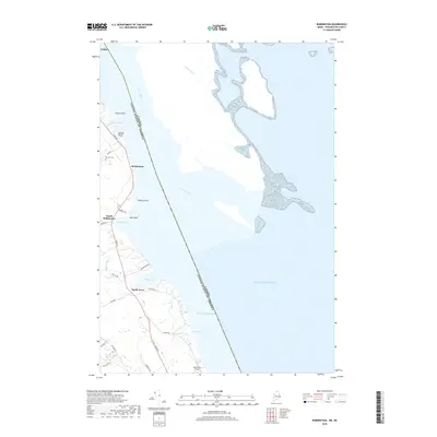
2018 Map of Robbinston
USGS Topo · Published 2018About this map
The St. Croix River serves as the international boundary between Maine and Canada, defining the eastern edge of this coastal landscape. The terrain is shaped by numerous coves and points along the Passamaquoddy Bay, where the small settlements of Robbinston, South Robbinston, and North Perry are linked by a network of local roads such as River Rd and Ridge Rd. This area reflects a quiet maritime character, where family-named landmarks like Brooks Bluff and Hinton Point overlook the water. Genealogists may find interest in the Brewer Cem situated near the riverbanks, while the presence of Morrison's Airport near the southern boundary shows the continued utility of the level coastal land. The map highlights the intimate connection between the inland brooks, such as James Brook and Pottle Brook, and the tidal inlets of Lewis Cove and Mill Cove.
Find a feature on this map
34 named features on this map. Tap any name to fly to it.
Don’t see what you’re looking for? This feature index may not catch every label — zoom into the map to look around manually.
Map Details
Editions of this 2018 Robbinston Map
This is the sole edition of this map. No revisions or reprints were ever made.
Other maps of this area

1907 · Eastport
USGS Topo · 1:48,000

1908 · Eastport
USGS Topo · 1:62,500

1929 · Robbinston
USGS Topo · 1:48,000

1931 · Robbinston
USGS Topo · 1:62,500

1943 · Eastport
USGS Topo · 1:62,500

1945 · Eastport
USGS Topo · 1:62,500

1949 · Robbinston
USGS Topo · 1:24,000

1949 · Pembroke
USGS Topo · 1:24,000

1949 · Red Beach
USGS Topo · 1:24,000

1949 · Devils Head
USGS Topo · 1:24,000