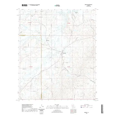
2020 Map of Robeline
USGS Topo · Published 2020About this map
Robeline and the neighboring settlement of Shamrock serve as the primary anchors of this Louisiana landscape, situated along the border of Natchitoches and Sabine Parishes. The area is defined by a dense network of waterways, including the Little River, the curiously named Bayous Adios, and several smaller tributaries like Coal Kiln Cr and Bajou Pedro. These streams weave through a terrain marked by local family-named loops and roads, suggesting a long-established rural community structure.
Find a feature on this map
75 named features on this map. Tap any name to fly to it.
Don’t see what you’re looking for? This feature index may not catch every label — zoom into the map to look around manually.
Map Details
Editions of this 2020 Robeline Map
This is the sole edition of this map. No revisions or reprints were ever made.
Other maps of this area

1935 · Hagewood
USGS Topo · 1:31,680

1937 · Bellwood
USGS Topo · 1:31,680

1937 · Campti SW
USGS Topo · 1:31,680

1938 · Hollis Creek
USGS Topo · 1:31,680

1938 · Allen
USGS Topo · 1:31,680

1942 · Many
USGS Topo · 1:62,500

1943 · Many
USGS Topo · 1:62,500

1943 · Provencal
USGS Topo · 1:62,500

1944 · Campti
USGS Topo · 1:62,500

1945 · Provencal
USGS Topo · 1:62,500