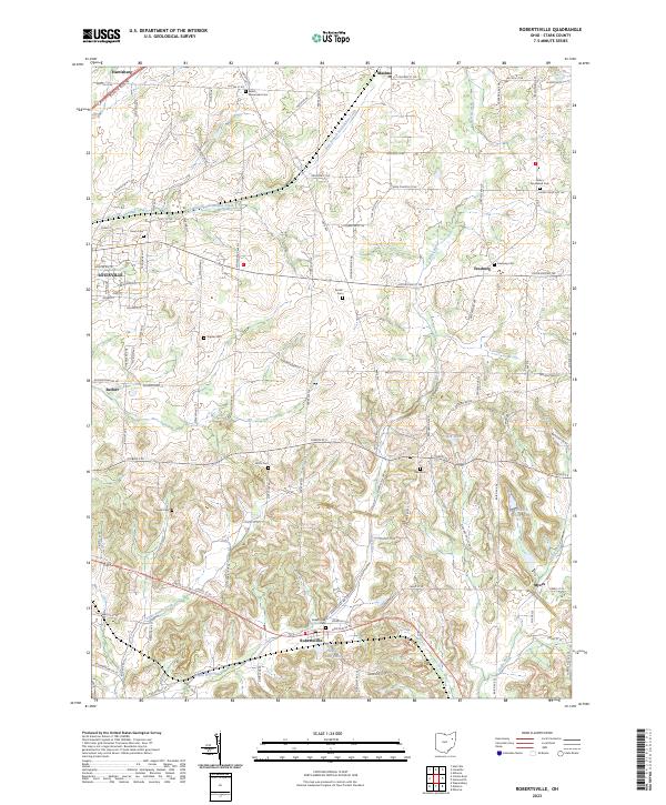
2023 Map of Robertsville
USGS Topo · Published 2023About this map
Robertsville and the eastern outskirts of Louisville anchor this Stark County landscape, characterized by small agricultural hamlets and a high density of family and congregational burial grounds. The map reveals a dense network of early crossroads and rural cemeteries, including the Beech Mennonite Cem and the Amish Cem, which reflect the area's deep religious and cultural heritage. Local topography is defined by the winding paths of East Branch Nimishillen Creek and Little Sandy Creek, with several small water bodies like Maple Leaf Lake and Copes Lake dotting the drainages. Tracing the intersections of Paris Ave NE and Easton St NE, one can find established settlements such as Harrisburg, Maximo, and Freeburg, each surrounded by historical family-named sites like Motts Cem and Snyder Cem.
Find a feature on this map
105 named features on this map. Tap any name to fly to it.
Don’t see what you’re looking for? This feature index may not catch every label — zoom into the map to look around manually.
Map Details
Editions of this 2023 Robertsville Map
This is the sole edition of this map. No revisions or reprints were ever made.
Other maps of this area

1901 · Canton
USGS Topo · 1:62,500

1903 · Canton
USGS Topo · 1:62,500

1909 · Alliance
USGS Topo · 1:62,500

1910 · Carrollton
USGS Topo · 1:62,500

1912 · Dover
USGS Topo · 1:62,500

1912 · Carrollton
USGS Topo · 1:62,500

1944 · Dover
USGS Topo · 1:62,500

1951 · Canton
USGS Topo · 1:250,000

1952 · Alliance
USGS Topo · 1:24,000

1953 · Canton
USGS Topo · 1:250,000