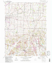
1994 Map of Robertsville
USGS Topo · Published 1998About this map
Nimishillen, Washington, Osnaburg, and Paris townships converge in this corner of Stark County, where a legacy of coal extraction and rural education is clearly etched. Extensive strip mine operations and smaller mines dominate the southern topography, contrasting with the structured agricultural grid to the north. These industrial sites sit alongside family landmarks and community centers like the Township Sch and Pleasant Grove Sch, while small local airfields like Yoder Airport hint at the area's mid-century modernization.
Find a feature on this map
48 named features on this map. Tap any name to fly to it.
Don’t see what you’re looking for? This feature index may not catch every label — zoom into the map to look around manually.
Map Details
Editions of this 1994 Robertsville Map
This is the sole edition of this map. No revisions or reprints were ever made.
Other maps of this area

1901 · Canton
USGS Topo · 1:62,500

1903 · Canton
USGS Topo · 1:62,500

1909 · Alliance
USGS Topo · 1:62,500

1910 · Carrollton
USGS Topo · 1:62,500

1912 · Dover
USGS Topo · 1:62,500

1912 · Carrollton
USGS Topo · 1:62,500

1944 · Dover
USGS Topo · 1:62,500

1951 · Canton
USGS Topo · 1:250,000

1952 · Alliance
USGS Topo · 1:24,000

1953 · Canton
USGS Topo · 1:250,000