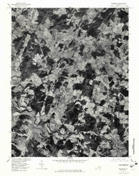
1977 Map of Rochelle
USGS Topo · Published 1981About this map
Rochelle and its surrounding rural communities in Madison County are captured here during the late 1970s via orthophotography. This aerial survey reveals the intricate patchwork of cleared farmland and dense woodlots that define this Piedmont landscape. Small crossroads settlements like Wolftown, Pratts, and Shelby serve as the primary anchors for local residents, connected by a winding network of country roads. The hydrology of the region is a dominant feature, with the Rapidan River and Conway River carving prominent paths through the terrain. To the south, Burtonville and Dawsonville sit near the confluence of the South River and the Rapidan, while Elk Run drains the central fields. This document offers a clear view of the agricultural patterns and land use in central Virginia before modern suburban expansion began to significantly alter the historic farm-to-market road structures.
Find a feature on this map
11 named features on this map. Tap any name to fly to it.
Don’t see what you’re looking for? This feature index may not catch every label — zoom into the map to look around manually.
Map Details
Editions of this 1977 Rochelle Map
This is the sole edition of this map. No revisions or reprints were ever made.
Other maps of this area

1892 · Gordonsville
USGS Topo · 1:125,000

1930 · Madison
USGS Topo · 1:48,000

1933 · Madison
USGS Topo · 1:62,500

1935 · Charlottesville
USGS Topo · 1:62,500

1939 · Charlottesville
USGS Topo · 1:62,500

1949 · Charlottesville
USGS Topo · 1:250,000

1949 · Charlottesville
USGS Topo · 1:62,500

1956 · Charlottesville
USGS Topo · 1:250,000

1961 · Gordonsville
USGS Topo · 1:62,500

1961 · Rapidan
USGS Topo · 1:62,500