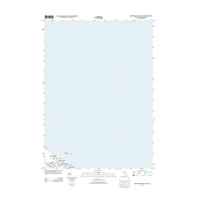
2013 Map of Rochester East OE N
USGS Topo · Published 2013About this map
Lake Ontario dominates this map, meeting the northern residential edge of Rochester where the Genesee River (indicated by piers) enters the lake. The waterfront is characterized by recreational and navigational landmarks, including Ontario Beach Park and the signaling points at Rochester Harbor Light and the East Pier Light. Dense suburban settlement patterns are evident in the established neighborhoods of Charlotte and Summerville, which grew around the lakefront's historic transit and leisure hubs. The map detail highlights the fine-grained street network of lakeside communities like Windsor Beach and White City, connected by thoroughfares such as Lake Ave and Beach Ave. This survey illustrates the modern configuration of the harbor area, including the Pelican River Marina, showing how the shoreline has been stabilized and developed for both maritime safety and public access.
Find a feature on this map
24 named features on this map. Tap any name to fly to it.
Don’t see what you’re looking for? This feature index may not catch every label — zoom into the map to look around manually.
Map Details
Editions of this 2013 Rochester East OE N Map
This is the sole edition of this map. No revisions or reprints were ever made.
Other maps of this area

1895 · Rochester
USGS Topo · 1:62,500

1895 · Ontario Beach
USGS Topo · 1:62,500

1898 · Rochester
USGS Topo · 1:62,500

1899 · Ontario Beach
USGS Topo · 1:62,500

1900 · Macedon
USGS Topo · 1:62,500

1912 · Rochester
USGS Topo · 1:62,500

1912 · Ontario Beach
USGS Topo · 1:62,500

1920 · Rochester
USGS Topo · 1:62,500

1931 · Rochester West
USGS Topo · 1:24,000

1931 · Rochester East
USGS Topo · 1:24,000