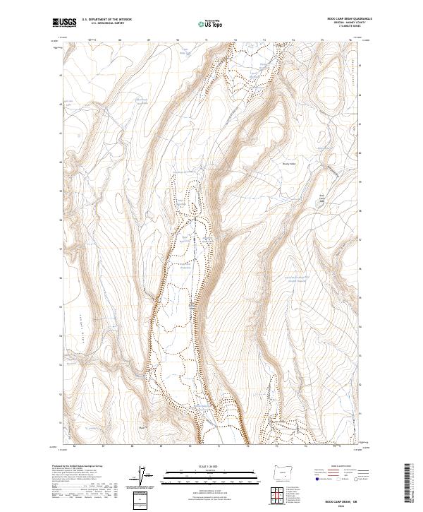
2024 Map of Rock Camp Draw
USGS Topo · Published 2024About this map
Juniper Ridge and the arid depressions of the Oregon high desert define this remote landscape in Harney County. The area is characterized by an extensive network of ephemeral water sources and stock reservoirs, essential for the livestock economy of the Great Basin. Points of interest include family-named or colloquial landmarks such as Old Jims Lake, Rock Camp Lake, and the curiously named Mule Tit. The topography reveals the transition from the high grounds of Juniper Ridge down into the expansive Warner Valley and Mule Springs Valley. Navigating this terrain are historic tracks like the NAT FOR DEV RD Road 6155 and Warner Va, which connect various isolated waterholes such as Flyspeck Waterhole and North Desert Waterhole Number Nineteen. This map provides a detailed view of the water management infrastructure, including the Dooley Bedground Reservoir and Con-Drum-Reservoir.
Find a feature on this map
35 named features on this map. Tap any name to fly to it.
Don’t see what you’re looking for? This feature index may not catch every label — zoom into the map to look around manually.
Map Details
Editions of this 2024 Rock Camp Draw Map
This is the sole edition of this map. No revisions or reprints were ever made.
Other maps of this area

1955 · Burns
USGS Topo · 1:250,000

1955 · Adel
USGS Topo · 1:250,000

1957 · Adel
USGS Topo · 1:250,000

1958 · Burns
USGS Topo · 1:250,000

1958 · Adel
USGS Topo · 1:250,000

1959 · Burns
USGS Topo · 1:250,000

1962 · Adel
USGS Topo · 1:250,000

1971 · Steamboat Point
USGS Topo · 1:24,000

1971 · Orejana Canyon
USGS Topo · 1:24,000

1971 · Rock Camp Draw
USGS Topo · 1:24,000