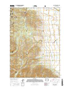
2017 Map of Rock Creek
USGS Topo · Published 2017About this map
The North Powder Valley serves as a stark transition between the high peaks of the Elkhorn Mountains and the irrigated agricultural lands of Baker County. Water management defines the landscape here, with an intricate network of historical irrigation features like the Hutchinson Ditch, Blume Zilkey Ditch, and Williams Ditch drawing from the Rock Creek and its tributaries. The map documents the edge of the Whitman National Forest, where the terrain rises sharply toward Antelope Peak and Bulger Hill. Local landmarks such as the Muddy Creek Airport and the geothermal activity at Fisher Hot Springs reflect the varied uses of the valley floor. High-altitude clearings like Fannie Meadows and Locken Meadow provide geographical markers for those tracing historical land use or timber boundaries in the upper elevations.
Find a feature on this map
82 named features on this map. Tap any name to fly to it.
Don’t see what you’re looking for? This feature index may not catch every label — zoom into the map to look around manually.
Map Details
Editions of this 2017 Rock Creek Map
This is the sole edition of this map. No revisions or reprints were ever made.
Other maps of this area

1901 · Baker City
USGS Topo · 1:125,000

1901 · Sumpter
USGS Topo · 1:125,000

1906 · Telocaset
USGS Topo · 1:125,000

1953 · Pendleton
USGS Topo · 1:250,000

1955 · Baker
USGS Topo · 1:250,000

1955 · Grangeville
USGS Topo · 1:250,000

1955 · Canyon City
USGS Topo · 1:250,000

1956 · Pendleton
USGS Topo · 1:250,000

1959 · Baker
USGS Topo · 1:250,000

1959 · Grangeville
USGS Topo · 1:250,000