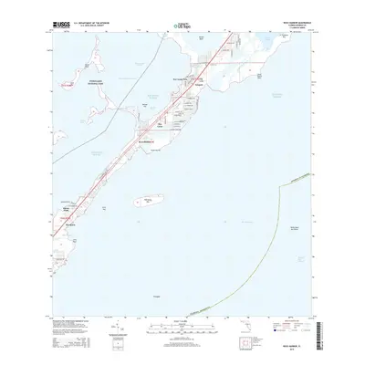
2015 Map of Rock Harbor
USGS Topo · Published 2015About this map
Everglades National Park and the central stretch of the Upper Keys define this maritime landscape in the mid-2010s. The map illustrates a dense residential and commercial corridor concentrated along the island's spine, particularly in Key Largo Park, Newport, and Rock Harbor. The intricate shoreline is characterized by a series of protected sounds and basins, including Tarpon Basin, Buttonwood Sound, and Largo Sound, all connected via the Intracostal Waterway.
Find a feature on this map
67 named features on this map. Tap any name to fly to it.
Don’t see what you’re looking for? This feature index may not catch every label — zoom into the map to look around manually.
Map Details
Editions of this 2015 Rock Harbor Map
This is the sole edition of this map. No revisions or reprints were ever made.
Other maps of this area

1947 · Garden Cove
USGS Topo · 1:24,000

1947 · Rock Harbor
USGS Topo · 1:24,000

1947 · Blackwater Sound
USGS Topo · 1:24,000

1949 · Blackwater Sound
USGS Topo · 1:24,000

1949 · Rock Harbor
USGS Topo · 1:24,000

1949 · Garden Cove
USGS Topo · 1:24,000

1956 · Miami
USGS Topo · 1:250,000

1958 · Miami
USGS Topo · 1:250,000

1971 · Tavernier
USGS Topo · 1:24,000

1971 · Plantation Key
USGS Topo · 1:24,000