
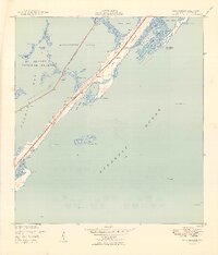
1949 Map of Rock Harbor
USGS Topo · Published 1949About this map
Key Largo's upper stretch appears here during the late 1940s, revealing a string of small settlements and navigational landmarks before the massive post-war development of the Florida Keys. Small communities like Newport and Rock Harbor are clustered along the main road, while St Margarets Ch and Getman Memorial Ch provide evidence of early social centers for residents. The western waters of Florida Bay and Buttonwood Sound are protected by the Everglades National Park boundary, emphasizing the region's conservation history.
Find a feature on this map
29 named features on this map. Tap any name to fly to it.
Don’t see what you’re looking for? This feature index may not catch every label — zoom into the map to look around manually.
Map Details
Editions of this 1949 Rock Harbor Map
2 editions found
Other maps of this area

1947 · Garden Cove
USGS Topo · 1:24,000

1947 · Rock Harbor
USGS Topo · 1:24,000

1947 · Blackwater Sound
USGS Topo · 1:24,000

1949 · Blackwater Sound
USGS Topo · 1:24,000

1949 · Garden Cove
USGS Topo · 1:24,000

1956 · Miami
USGS Topo · 1:250,000

1958 · Miami
USGS Topo · 1:250,000

1971 · Tavernier
USGS Topo · 1:24,000

1971 · Plantation Key
USGS Topo · 1:24,000
1972 · Joe Bay
USGS Topo · 1:24,000