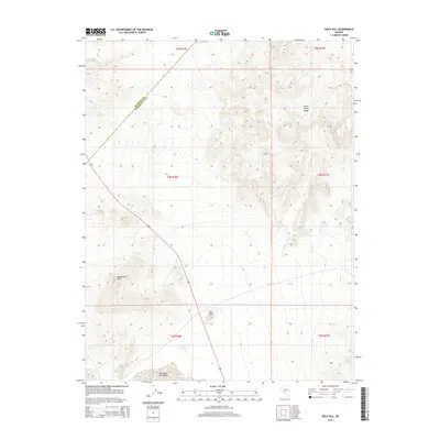
2014 Map of Rock Hill
USGS Topo · Published 2014About this map
Columbus Salt Marsh dominates the southern reaches of this landscape, marking a stark contrast to the surrounding elevations. To the north and east, the terrain rises into the Monte Cristo Range, while the Candelaria Hills define the southwestern topography. The county boundary between Mineral Co and Esmeralda Co cuts diagonally across the northwestern corner of the sheet, providing a precise jurisdictional reference for local historians. Centrally located, Rock Hill serves as a prominent landmark amidst the high desert environment. The primary transit corridor is defined by Highway 95, which runs north-south through the center of the quadrangle, linking the salt marsh basins with the higher mountain passes. This survey illustrates the relationship between the low-lying alkali flats and the rugged western Nevada ranges during the early 21st century.
Find a feature on this map
12 named features on this map. Tap any name to fly to it.
Don’t see what you’re looking for? This feature index may not catch every label — zoom into the map to look around manually.
Map Details
Editions of this 2014 Rock Hill Map
This is the sole edition of this map. No revisions or reprints were ever made.
Other maps of this area

1907 · Tonopah
USGS Topo · 1:250,000

1908 · Tonopah
USGS Topo · 1:250,000

1909 · Hawthorne
USGS Topo · 1:250,000

1911 · Hawthorne
USGS Topo · 1:250,000

1915 · Hawthorne
USGS Topo · 1:250,000

1948 · Walker Lake
USGS Topo · 1:250,000

1956 · Tonopah
USGS Topo · 1:250,000

1957 · Walker Lake
USGS Topo · 1:250,000

1959 · Tonopah
USGS Topo · 1:250,000

1962 · Walker Lake
USGS Topo · 1:250,000