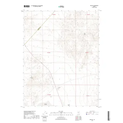
2018 Map of Rock Hill
USGS Topo · Published 2018About this map
Columbus Salt Marsh dominates the southwestern corner of this desert landscape, marking a significant hydrologic feature at the base of the Candelaria Hills. The terrain is characterized by the high, ridged contours of the Monte Cristo Range to the northeast and the isolated peak of Rock Hill rising above the surrounding basin. This area represents a classic Great Basin environment where drainage from the surrounding ranges terminates in the salt marsh and the broad Columbia Valley. The Mineral Co / Esmeralda Co boundary cuts diagonally across the northwestern portion of the map, while US Route 95 provides the primary transit corridor through this arid corridor of Nevada. The survey details the stark contrast between the steep, complex relief of the mountain ranges and the flat, alluvial floors of the valley systems.
Find a feature on this map
13 named features on this map. Tap any name to fly to it.
Don’t see what you’re looking for? This feature index may not catch every label — zoom into the map to look around manually.
Map Details
Editions of this 2018 Rock Hill Map
This is the sole edition of this map. No revisions or reprints were ever made.
Other maps of this area

1907 · Tonopah
USGS Topo · 1:250,000

1908 · Tonopah
USGS Topo · 1:250,000

1909 · Hawthorne
USGS Topo · 1:250,000

1911 · Hawthorne
USGS Topo · 1:250,000

1915 · Hawthorne
USGS Topo · 1:250,000

1948 · Walker Lake
USGS Topo · 1:250,000

1956 · Tonopah
USGS Topo · 1:250,000

1957 · Walker Lake
USGS Topo · 1:250,000

1959 · Tonopah
USGS Topo · 1:250,000

1962 · Walker Lake
USGS Topo · 1:250,000