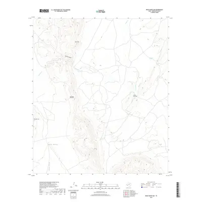
2019 Map of Rock House Gap
USGS Topo · Published 2019About this map
The Del Norte Mountains dominate this Brewster County landscape, defining a region of stark elevation changes and significant natural drainage systems. High points like Black Peak and the prominent Elephant Mtn overlook a network of seasonal watercourses, including Maravillas Cr and Dugout Cr. The geography is bisected by the namesake Rock House Gap, a strategic passage through the highlands that likely influenced movement across this arid terrain for generations.
Find a feature on this map
12 named features on this map. Tap any name to fly to it.
Don’t see what you’re looking for? This feature index may not catch every label — zoom into the map to look around manually.
Map Details
Editions of this 2019 Rock House Gap Map
This is the sole edition of this map. No revisions or reprints were ever made.
Other maps of this area

1895 · Alpine
USGS Topo · 1:125,000

1917 · Santiago Peak
USGS Topo · 1:62,500

1917 · Buck Hill
USGS Topo · 1:62,500

1918 · Bone Spring
USGS Topo · 1:125,000

1918 · Buck Hill
USGS Topo · 1:62,500

1918 · Santiago Peak
USGS Topo · 1:62,500

1920 · Monument Spring
USGS Topo · 1:62,500

1921 · Monument Spring
USGS Topo · 1:62,500

1925 · Buck Hill
USGS Topo · 1:62,500
1938 · Santiago Peak
USGS Topo · 1:62,500