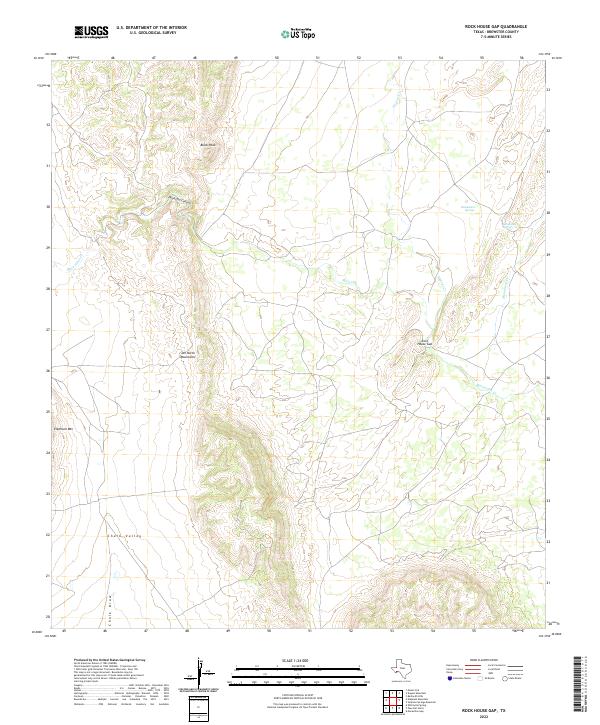
2022 Map of Rock House Gap
USGS Topo · Published 2022About this map
Rock House Gap serves as a prominent landmark within the high desert terrain of Brewster County, where the southern reaches of the Del Norte Mountains meet the surrounding basins. This topographic record illustrates the intricate drainage patterns of the region, anchored by the seasonal flows of Maravillas Cr and Dugout Cr. The presence of both Monument Springs and the singular Monument Spring indicates critical water sources in a landscape dominated by arid features like Chalk Valley and Chalk Draw. Elevated terrain is defined by the towering presence of Elephant Mtn and Black Peak, while the serpentine path of Doubtful Canyon suggests the complex erosional history of the Trans-Pecos region. The map highlights a network of remote 4WD tracks and local connectors that link these disparate springs and peaks, reflecting the area's continued use for ranching and resource management.
Find a feature on this map
12 named features on this map. Tap any name to fly to it.
Don’t see what you’re looking for? This feature index may not catch every label — zoom into the map to look around manually.
Map Details
Editions of this 2022 Rock House Gap Map
This is the sole edition of this map. No revisions or reprints were ever made.
Other maps of this area

1895 · Alpine
USGS Topo · 1:125,000

1917 · Santiago Peak
USGS Topo · 1:62,500

1917 · Buck Hill
USGS Topo · 1:62,500

1918 · Bone Spring
USGS Topo · 1:125,000

1918 · Buck Hill
USGS Topo · 1:62,500

1918 · Santiago Peak
USGS Topo · 1:62,500

1920 · Monument Spring
USGS Topo · 1:62,500

1921 · Monument Spring
USGS Topo · 1:62,500

1925 · Buck Hill
USGS Topo · 1:62,500
1938 · Santiago Peak
USGS Topo · 1:62,500