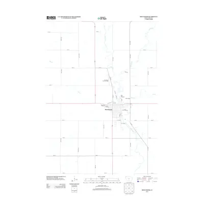
2013 Map of Rock Rapids
USGS Topo · Published 2013About this map
Rock Rapids serves as the focal point of this Northwest Iowa landscape, situated at the confluence of the Rock River and Kanaranzi Cr. The map reveals a highly structured agricultural grid, where numbered roads like 110th St and 120th St intersect with named avenues such as Garfield Ave and Harrison Ave. This geometry is only broken by the wandering paths of Moon Cr and Tom Cr as they feed into the larger river system. Within the city limits, civic life is anchored by the Lyon County Fairgrounds and Rock Rapids Municipal Airport, while recreational spaces like Island Park Campground and Westside Park Campground highlight the local importance of the riverbanks. The survey captures the town's role as a regional hub, connected by thoroughfares such as Speer Expy and K52 Blvd, reflecting a community deeply integrated with its surrounding prairie and waterways.
Find a feature on this map
42 named features on this map. Tap any name to fly to it.
Don’t see what you’re looking for? This feature index may not catch every label — zoom into the map to look around manually.
Map Details
Editions of this 2013 Rock Rapids Map
This is the sole edition of this map. No revisions or reprints were ever made.
Other maps of this area

1955 · Sioux Falls
USGS Topo · 1:250,000

1958 · Sioux Falls
USGS Topo · 1:250,000

1967 · Hills
USGS Topo · 1:24,000

1967 · Ellsworth
USGS Topo · 1:24,000

1967 · Ash Creek
USGS Topo · 1:24,000

1971 · Edna
USGS Topo · 1:24,000

1971 · Lester
USGS Topo · 1:24,000

1971 · George West
USGS Topo · 1:24,000

1971 · Rock Rapids
USGS Topo · 1:24,000

1971 · Doon
USGS Topo · 1:24,000