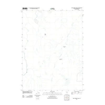
2011 Map of Rock Spring Table
USGS Topo · Published 2011About this map
Rock Spring Table dominates this high-desert landscape in northern Nevada, where water remains the primary driver of human settlement and infrastructure. Small-scale ranching operations like Wilson Ranch and Alkali Ranch are positioned along the western drainage of Virgin Creek, marking the sparse habitation found in this part of Humboldt County. The map documents an intricate network of seasonal water sources and catchment systems essential for life in the Great Basin, from the Rock Spring Table Reservoir to isolated points like Cottonwood Spring and Onion Lake. While the expansive Rock Spring Basin appears largely untouched, the presence of the East Rock Spring Campground along Sagebrush Creek indicates the area's transition into a space for modern recreation and land management. The drainage patterns of Rock Spring and its associated creeks highlight the topographical challenges faced by early settlers and contemporary ranchers alike.
Find a feature on this map
11 named features on this map. Tap any name to fly to it.
Don’t see what you’re looking for? This feature index may not catch every label — zoom into the map to look around manually.
Map Details
Editions of this 2011 Rock Spring Table Map
This is the sole edition of this map. No revisions or reprints were ever made.
Other maps of this area

1886 · Disaster
USGS Topo · 1:250,000

1889 · Long Valley
USGS Topo · 1:250,000

1893 · Disaster
USGS Topo · 1:250,000

1954 · Vya
USGS Topo · 1:250,000

1958 · Vya
USGS Topo · 1:250,000

1962 · Vya
USGS Topo · 1:250,000

1965 · Railroad Point
USGS Topo · 1:62,500

1965 · Idaho Canyon
USGS Topo · 1:62,500

1965 · Rock Spring Table
USGS Topo · 1:62,500

1966 · Big Spring Butte
USGS Topo · 1:62,500