
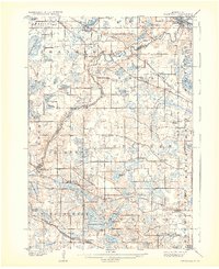
1909 Map of Rockford
USGS Topo · Published 1909About this map
The Crow River winds through the heart of this 1900s landscape, serving as the natural boundary between Wright and Hennepin counties. This era reveals a transition from agrarian milling to rail-dependent trade, anchored by established settlements like St Michael and Rockford. Along the river's bend, Berning Mill stands as a marker of local industry, while the Great Northern and Minneapolis St Paul and Sault Ste Marie railroads define the southern and northern transport corridors. The landscape is characterized by its dense concentration of water bodies, including the prominent Lake Independence and the expansive Pelican Lake. Small community hubs such as Burschville, Loretto, and Hamel are visible alongside social anchors like Salem Church and the Adventist Academy, providing a detailed look at the social and economic fabric of these rural townships before the expansion of the Twin Cities.
Find a feature on this map
80 named features on this map. Tap any name to fly to it.
Don’t see what you’re looking for? This feature index may not catch every label — zoom into the map to look around manually.
Map Details
Editions of this 1909 Rockford Map
2 editions found
Other maps of this area

1896 · Minneapolis
USGS Topo · 1:62,500

1901 · Minneapolis
USGS Topo · 1:62,500

1902 · Anoka
USGS Topo · 1:62,500

1905 · Minnetonka
USGS Topo · 1:62,500

1907 · Minnetonka
USGS Topo · 1:62,500

1916 · St. Francis
USGS Topo · 1:62,500

1919 · St. Francis
USGS Topo · 1:62,500

1953 · Saint Paul
USGS Topo · 1:250,000

1953 · Stillwater
USGS Topo · 1:250,000

1954 · Hopkins
USGS Topo · 1:24,000