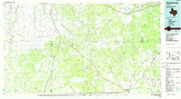
1985 Map of Rocksprings
USGS Topo · Published 1986About this map
Rocksprings and the rural community of Roosevelt anchor this 1980s landscape at the intersection of the Edwards, Sutton, Val Verde, and Crockett county lines. The terrain is defined by an intricate network of drainage draws, including Granger Draw, Eightmile Draw, and Tenmile Draw, which feed into the primary river systems of the Devils River and the West Fork Llano River. The map reveals a subterranean world typical of the Edwards Plateau karst topography, marking specific locations for Felton Cave, Word Cave, and Mayfield Cave. Notable landmarks such as Panther Bluff, Cedar Knob, and Twin Buttes rise above the drainage basins, while historical transport routes like Old Road Canyon weave through the draws. This survey captures a moment in the mid-1980s when the region remained dominated by large ranch holdings and isolated terrain features, with landmarks like Cusenbary and Buckley signifying the enduring footprint of local families on the land.
Find a feature on this map
66 named features on this map. Tap any name to fly to it.
Don’t see what you’re looking for? This feature index may not catch every label — zoom into the map to look around manually.
Map Details
Editions of this 1985 Rocksprings Map
This is the sole edition of this map. No revisions or reprints were ever made.
Other maps of this area

1893 · Rock Springs
USGS Topo · 1:125,000

1893 · Fort McKavett
USGS Topo · 1:125,000

1893 · Nueces
USGS Topo · 1:125,000

1896 · Nueces
USGS Topo · 1:125,000

1926 · Segovia 2-c
USGS Topo · 1:48,000

1932 · Junction
USGS Topo · 1:62,500

1943 · Carta Valley
USGS Topo · 1:62,500

1944 · Dry Devil
USGS Topo · 1:62,500

1944 · Indian Creek
USGS Topo · 1:62,500

1944 · Baker Crossing
USGS Topo · 1:62,500