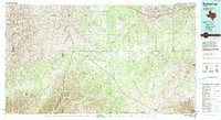
1993 Map of Rocksprings
USGS Topo · Published 1993About this map
Rocksprings serves as the central hub of this West Texas landscape, situated atop the Edwards Plateau where the headwaters of several significant drainage systems begin their descent. The map reveals a complex network of ephemeral watercourses including Cusenbary Draw, Tenmile Draw, and Buffalo Draw, which illustrate the region's reliance on seasonal runoff. Historical transport routes are represented by the Old Spanish Road, which traverses the plateau, while the rugged topography is punctuated by landmarks such as Cedar Knob. This 1993 edition, compiled from earlier surveys and 1980s aerial photography, documents the sparse settlement patterns and the transition between the Dry Devils River watershed and the upper reaches of the South Llano River and Nueces River. The presence of a Radio Tower and a Gravel Pit near the town center reflects the modest modern infrastructure and industry supporting this ranching community.
Find a feature on this map
30 named features on this map. Tap any name to fly to it.
Don’t see what you’re looking for? This feature index may not catch every label — zoom into the map to look around manually.
Map Details
Editions of this 1993 Rocksprings Map
This is the sole edition of this map. No revisions or reprints were ever made.
Other maps of this area

1893 · Rock Springs
USGS Topo · 1:125,000

1893 · Fort McKavett
USGS Topo · 1:125,000

1893 · Nueces
USGS Topo · 1:125,000

1896 · Nueces
USGS Topo · 1:125,000

1926 · Segovia 2-c
USGS Topo · 1:48,000

1932 · Junction
USGS Topo · 1:62,500

1943 · Carta Valley
USGS Topo · 1:62,500

1944 · Dry Devil
USGS Topo · 1:62,500

1944 · Indian Creek
USGS Topo · 1:62,500

1944 · Baker Crossing
USGS Topo · 1:62,500