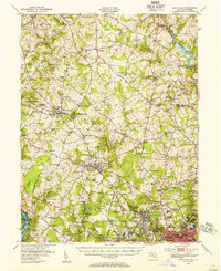
1944 Map of Rockville
USGS Topo · Published 1955About this map
The Potomac River forms the southwestern edge of this landscape, which transitions from rural Montgomery County farmland into early suburban development. Small crossroads like Laytonsville, Sunshine, and Unity dot the northern reaches, while the Baltimore and Ohio RR serves as a primary transit spine through Gaithersburg and Rockville. A notable concentration of mid-century infrastructure is visible near the southern border, including the sprawling grounds of the Naval Medical Center and the Georgetown Preparatory Sch.
Find a feature on this map
119 named features on this map. Tap any name to fly to it.
Don’t see what you’re looking for? This feature index may not catch every label — zoom into the map to look around manually.
Map Details
Editions of this 1944 Rockville Map
This is the sole edition of this map. No revisions or reprints were ever made.
Other maps of this area

1890 · Mt. Vernon
USGS Topo · 1:125,000

1891 · Mt. Vernon
USGS Topo · 1:125,000

1892 · Laurel
USGS Topo · 1:62,500

1892 · Ellicott
USGS Topo · 1:62,500

1893 · Frederick
USGS Topo · 1:125,000

1894 · Ellicott
USGS Topo · 1:62,500

1894 · Laurel
USGS Topo · 1:62,500

1894 · Frederick
USGS Topo · 1:125,000

1894 · Mt. Vernon
USGS Topo · 1:125,000

1897 · Laurel
USGS Topo · 1:62,500