
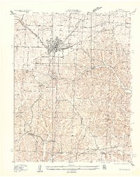
1935 Map of Rocky Mount
USGS Topo · Published 1935About this map
The Morgan and Miller County borderlands are defined by the winding tributaries of the Moreau Creek and the recently formed shoreline of the Lake of the Ozarks. This 1935 survey captures the rural landscape as the northern reaches of the reservoir began to transform the local topography, creating indentations like Bogue Bay. While the Chicago Rock Island and Pacific railroad serves the northern corridor through Barnett Sta, the southern hills remain a network of hollows and ridges populated by numerous one-room schoolhouses and family-named landmarks. Features like the Stover Coal Bank indicate localized mining activity, while schools such as Laurel Ridge School and Rock Island School speak to the dispersed settlement patterns of the era. Genealogists will find particular value in the identification of several small burial grounds, including the Ailey Lamb Cem and Taylor Cem.
Find a feature on this map
39 named features on this map. Tap any name to fly to it.
Don’t see what you’re looking for? This feature index may not catch every label — zoom into the map to look around manually.
Map Details
Editions of this 1935 Rocky Mount Map
This is the sole edition of this map. No revisions or reprints were ever made.
Other maps of this area

1888 · Versailles
USGS Topo · 1:125,000

1893 · Versailles
USGS Topo · 1:125,000

1904 · Eldon
USGS Topo · 1:62,500

1904 · Gravois Mills
USGS Topo · 1:62,500

1932 · Versailles No 4
USGS Topo · 1:48,000

1934 · Purvis
USGS Topo · 1:24,000

1934 · Lake Ozark
USGS Topo · 1:24,000

1934 · Bagnell
USGS Topo · 1:24,000

1935 · Gravois Mills
USGS Topo · 1:24,000
1935 · Eldon
USGS Topo · 1:24,000