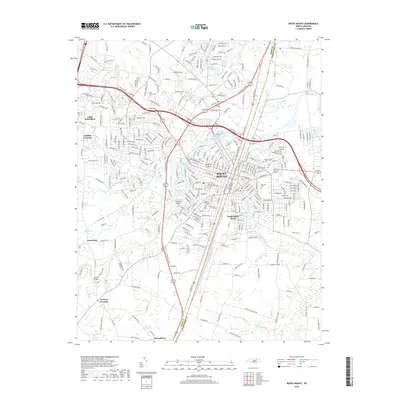
2019 Map of Rocky Mount
USGS Topo · Published 2019About this map
Rocky Mount straddles the Nash Co and Edgecombe Co line, where the Tar River and its accompanying Little Falls define the early urban industrial core. This 2019 survey documents the extensive residential and commercial expansion of the region, including outlying communities like Little Easonburg and the academic footprint of Nash Community Coll to the west. The landscape transitions from the dense street grids of South Rocky Mount to the lower-lying riparian systems of Cokey Swamp and Little Cokey Swamp in the south.
Find a feature on this map
46 named features on this map. Tap any name to fly to it.
Don’t see what you’re looking for? This feature index may not catch every label — zoom into the map to look around manually.
Map Details
Editions of this 2019 Rocky Mount Map
This is the sole edition of this map. No revisions or reprints were ever made.
Other maps of this area

1902 · Rocky Mount
USGS Topo · 1:62,500

1902 · Tarboro
USGS Topo · 1:62,500

1903 · Tarboro
USGS Topo · 1:62,500

1904 · Rocky Mount
USGS Topo · 1:62,500

1953 · Norfolk
USGS Topo · 1:250,000

1953 · Rocky Mount
USGS Topo · 1:250,000

1954 · Rocky Mount
USGS Topo · 1:250,000

1961 · Whitakers
USGS Topo · 1:24,000

1963 · Red Oak
USGS Topo · 1:24,000

1963 · Drake
USGS Topo · 1:24,000