2022 Map of Rocky Mount
USGS Topo · Published 2022About this map
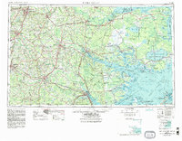
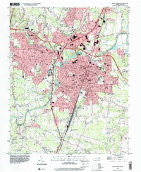
Rocky Mount serves as the focal point for this contemporary survey, situated along the border of Nash and Edgecombe counties. The city's modern infrastructure is defined by the convergence of major transportation corridors including I-95, Us 301, and Us 64, which weave through residential and commercial districts. Education and civic landmarks like Edgecombe Community College are central to the urban landscape, while the Tar River and its accompanying Little Falls provide a natural boundary that has historically influenced the area's development.
Find a feature on this map
29 named features on this map. Tap any name to fly to it.
Don’t see what you’re looking for? This feature index may not catch every label — zoom into the map to look around manually.
Map Details
Editions of this 2022 Rocky Mount Map
This is the sole edition of this map. No revisions or reprints were ever made.
Historical Maps of Quail Hollow Through Time
9 maps found