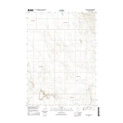
2015 Map of Rockyford NW
USGS Topo · Published 2015About this map
Red Dog Table rises above the surrounding landscape in this 2015 survey of the Wounded Knee District. The terrain is defined by the winding course of the White River, which snakes through the southeastern corner of the quadrangle, and the intricate drainage patterns of E Horse Cr. These waterways cut through the high plains, creating distinct geographical markers like Wolf Canyon to the north. A single primary roadway, Bia 8, provides access through the southern reaches of the territory, connecting the prominent plateau of Red Dog Table with the river valley. The map documents the vast, open character of Oglala Lakota County, where the natural hydrology of streams like Sand Cr remains the dominant influence on the land's structure and any potential settlement patterns.
Find a feature on this map
13 named features on this map. Tap any name to fly to it.
Don’t see what you’re looking for? This feature index may not catch every label — zoom into the map to look around manually.
Map Details
Editions of this 2015 Rockyford NW Map
This is the sole edition of this map. No revisions or reprints were ever made.
Other maps of this area

1950 · Stirk Table
USGS Topo · 1:24,000

1950 · Cuny Table East
USGS Topo · 1:24,000

1951 · Rockyford SW
USGS Topo · 1:24,000

1951 · Rockyford NW
USGS Topo · 1:24,000

1951 · Willow Creek NE
USGS Topo · 1:24,000

1951 · Rockyford
USGS Topo · 1:24,000

1951 · Rockyford SE
USGS Topo · 1:24,000

1951 · Cuny Table West
USGS Topo · 1:24,000

1955 · Hot Springs
USGS Topo · 1:250,000

1967 · Willow Creek
USGS Topo · 1:24,000