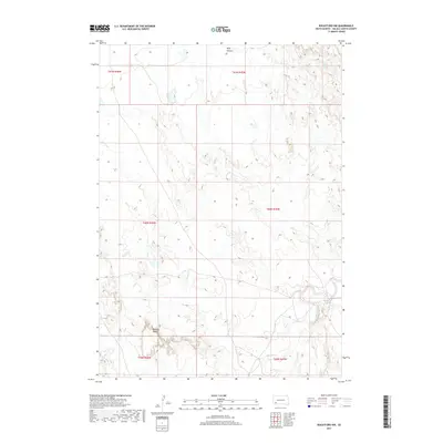
2017 Map of Rockyford NW
USGS Topo · Published 2017About this map
Red Dog Table rises as a prominent landform above the surrounding drainage basins in this section of Oglala Lakota County. The landscape is defined by the intricate dendritic patterns of several waterways, most notably the White River which cuts through the southeastern portion of the quadrangle. High plateaus give way to deeply carved seasonal drainages such as Wolf Canyon and the various branches of Horse Creek, including E Horse Cr and W Horse Cr. These features illustrate the erosion-prone nature of the terrain, where water has sculpted the high plains into a complex network of draws and mesas. This topography influenced the placement of early ranching and transit corridors, following the flatter ground of the tables or the natural paths provided by the creeks like Sand Cr.
Find a feature on this map
12 named features on this map. Tap any name to fly to it.
Don’t see what you’re looking for? This feature index may not catch every label — zoom into the map to look around manually.
Map Details
Editions of this 2017 Rockyford NW Map
This is the sole edition of this map. No revisions or reprints were ever made.
Other maps of this area

1950 · Stirk Table
USGS Topo · 1:24,000

1950 · Cuny Table East
USGS Topo · 1:24,000

1951 · Rockyford SW
USGS Topo · 1:24,000

1951 · Rockyford NW
USGS Topo · 1:24,000

1951 · Willow Creek NE
USGS Topo · 1:24,000

1951 · Rockyford
USGS Topo · 1:24,000

1951 · Rockyford SE
USGS Topo · 1:24,000

1951 · Cuny Table West
USGS Topo · 1:24,000

1955 · Hot Springs
USGS Topo · 1:250,000

1967 · Willow Creek
USGS Topo · 1:24,000