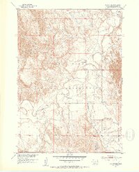
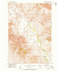
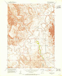
1951 Map of Rockyford
USGS Topo · Published 1953About this map
The Pine Ridge Indian Reservation unfolds across this early 1950s survey, dominated by the winding course of the White River. The settlement of Rockyford sits in the northeast corner, serving as a focal point for the surrounding prairie and tablelands. The landscape is defined by its drainages, including Wounded Knee Creek and Fog Creek, which cut through the terrain toward the river valley.
Find a feature on this map
11 named features on this map. Tap any name to fly to it.
Don’t see what you’re looking for? This feature index may not catch every label — zoom into the map to look around manually.
Map Details
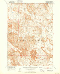
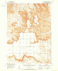
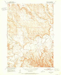
Editions of this 1951 Rockyford Map
3 editions found

Other maps of this area
1950 · Stirk Table
USGS Topo · 1:24,000
1950 · Cuny Table East
USGS Topo · 1:24,000
1950 · Imlay SW
USGS Topo · 1:24,000

1951 · Rockyford SW
USGS Topo · 1:24,000
1951 · Sharps Corner
USGS Topo · 1:24,000

1951 · Rockyford NW
USGS Topo · 1:24,000
1951 · Rockyford
USGS Topo · 1:24,000

1951 · Rockyford SE
USGS Topo · 1:24,000

1955 · Hot Springs
USGS Topo · 1:250,000

1981 · Wall
USGS Topo · 1:100,000