
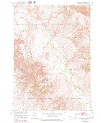
1951 Map of Sharps Corner
USGS Topo · Published 1953About this map
Pine Ridge Indian Reservation lands dominate this mid-century landscape, where the winding course of Porcupine Creek carves through the undulating topography of Shannon County. The mapping, completed as part of the Department of the Interior's Missouri River Basin development program, captures a rural infrastructure centered on isolated community hubs. Sharps Corner serves as a primary junction in the southern portion of the sheet, while social life in the northern reaches is anchored by Rockyford Ch and the Gull Sch. This 1951 field-checked survey provides a clear view of the road network and terrain before modern expansion, highlighting landmarks like Chimney Butte and the remote St Luke Ch situated along the valley floor near the reservation boundaries.
Find a feature on this map
13 named features on this map. Tap any name to fly to it.
Don’t see what you’re looking for? This feature index may not catch every label — zoom into the map to look around manually.
Map Details
Editions of this 1951 Sharps Corner Map
2 editions found
Other maps of this area

1950 · Stirk Table
USGS Topo · 1:24,000

1950 · Imlay SW
USGS Topo · 1:24,000

1950 · Imlay SE
USGS Topo · 1:24,000

1951 · Rockyford
USGS Topo · 1:24,000

1951 · Rockyford SE
USGS Topo · 1:24,000

1955 · Hot Springs
USGS Topo · 1:250,000

1981 · Wall
USGS Topo · 1:100,000

1981 · Evergreen
USGS Topo · 1:25,000

1981 · Evergreen NE
USGS Topo · 1:24,000

1985 · Pine Ridge
USGS Topo · 1:100,000