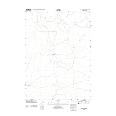
2012 Map of Rockyford SE
USGS Topo · Published 2012About this map
Grass Cr meanders extensively through this portion of the Wounded Knee District, defining the drainage patterns of the western half of the quadrangle. In the northeast, the iconic Wounded Knee Cr flows toward the north, marking a landscape of significant historical weight in South Dakota. The area is characterized by a sparse network of local transportation routes, most notably Grass Creek Rd, which traverses the southern and central sections. This 2012 survey by the U. S. Geological Survey captures a remote prairie landscape where the natural watercourses remain the primary geographic landmarks. The map illustrates how human infrastructure, limited to thin lines of unpaved and local roads, follows the contours of the drainage basins rather than imposing a rigid grid on the terrain.
Find a feature on this map
3 named features on this map. Tap any name to fly to it.
Don’t see what you’re looking for? This feature index may not catch every label — zoom into the map to look around manually.
Map Details
Editions of this 2012 Rockyford SE Map
This is the sole edition of this map. No revisions or reprints were ever made.
Other maps of this area

1951 · Rockyford SW
USGS Topo · 1:24,000

1951 · Sharps Corner
USGS Topo · 1:24,000

1951 · Rockyford NW
USGS Topo · 1:24,000

1951 · Rockyford
USGS Topo · 1:24,000

1951 · Rockyford SE
USGS Topo · 1:24,000

1955 · Hot Springs
USGS Topo · 1:250,000

1967 · Pine Ridge NE
USGS Topo · 1:24,000

1967 · Manderson
USGS Topo · 1:24,000

1967 · Oglala
USGS Topo · 1:24,000

1981 · Evergreen
USGS Topo · 1:25,000