
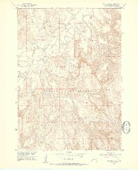
1951 Map of Rockyford SW
USGS Topo · Published 1953About this map
Pine Ridge stretches across the center of this 1951 survey, defining the topographical character of the Pine Ridge Indian Reservation. The White River meanders through the northwest, its course marked by a complex network of sandbars and shifting channels that contrast with the dissected badlands terrain to the south. This survey was conducted as part of a Department of the Interior program for the development of the Missouri River Basin, capturing the landscape just as aerial photogrammetry began to refine modern mapping. Along the northern banks of the river, Horse Creek joins the main flow near a small, unnamed Cem, providing a specific point of interest for those tracing family history or early settlement patterns in this part of Shannon County.
Find a feature on this map
6 named features on this map. Tap any name to fly to it.
Don’t see what you’re looking for? This feature index may not catch every label — zoom into the map to look around manually.
Map Details
Editions of this 1951 Rockyford SW Map
2 editions found
Other maps of this area

1951 · Rockyford NW
USGS Topo · 1:24,000

1951 · Willow Creek NE
USGS Topo · 1:24,000

1951 · Rockyford
USGS Topo · 1:24,000

1951 · Rockyford SE
USGS Topo · 1:24,000

1955 · Hot Springs
USGS Topo · 1:250,000

1967 · Pine Ridge NE
USGS Topo · 1:24,000

1967 · Oglala
USGS Topo · 1:24,000

1967 · Slim Butte NE
USGS Topo · 1:24,000

1967 · Willow Creek
USGS Topo · 1:24,000

1985 · Pine Ridge
USGS Topo · 1:100,000