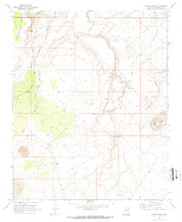
1969 Map of Roden Crater
USGS Topo · Published 1972About this map
Woodhouse Mesa and the volcanic landforms of north-central Arizona dominate this late 1960s survey, which includes the northeastern corner of Wupatki National Monument. The landscape is defined by its drainage patterns and isolated water sources, including Peshlaki Spring and Coyote Spring in the northwest, and Little Roden Spring tucked into the complex topography near the center. The eponymous Roden Crater stands out as a distinct geological feature on the eastern edge of the quadrangle. Sparse human presence is evidenced primarily by several Ruins and scattered Water Tanks, alongside a network of Jeep Trails that traverse the arid terrain. The map captures the area's physical geography through a series of washes, such as Kana a Wash, Stone House Wash, and Little Roden Wash, which underscore the region's relationship with seasonal water flow.
Find a feature on this map
16 named features on this map. Tap any name to fly to it.
Don’t see what you’re looking for? This feature index may not catch every label — zoom into the map to look around manually.
Map Details
Editions of this 1969 Roden Crater Map
2 editions found
Other maps of this area

1886 · San Francisco Mtns
USGS Topo · 1:250,000

1891 · San Francisco Mtns
USGS Topo · 1:250,000

1894 · San Francisco Mtns
USGS Topo · 1:250,000

1899 · San Francisco Mtns
USGS Topo · 1:250,000

1947 · Flagstaff
USGS Topo · 1:250,000

1954 · Flagstaff
USGS Topo · 1:250,000

1955 · Black Falls 4 SW
USGS Topo · 1:24,000

1958 · Flagstaff
USGS Topo · 1:250,000

1960 · Flagstaff
USGS Topo · 1:250,000

1962 · Flagstaff
USGS Topo · 1:250,000