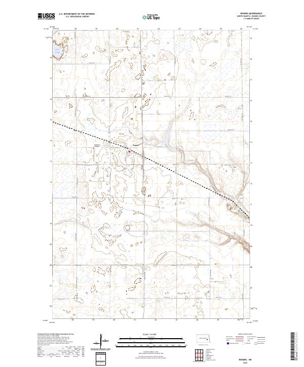
2024 Map of Rogers
USGS Topo · Published 2024About this map
Rogers serves as the central settlement in this portion of Barnes County, defined by a grid of agricultural section lines and localized water bodies. The landscape is dotted with wetlands and depressions, including Orner Slough in the northwest and Tomahawk Lake near the center of the quadrangle. Transportation is anchored by the presence of Railway Ave and the small-scale aviation facility at Anderson Airport, reflecting the region’s reliance on both rail and light air travel for connectivity. A meticulous network of numbered avenues and streets, such as 109th Ave SE and 24th St SE, organizes the surrounding prairie, illustrating the enduring township and range survey system that governs North Dakota's rural geography.
Find a feature on this map
24 named features on this map. Tap any name to fly to it.
Don’t see what you’re looking for? This feature index may not catch every label — zoom into the map to look around manually.
Map Details
Editions of this 2024 Rogers Map
This is the sole edition of this map. No revisions or reprints were ever made.
Other maps of this area

1897 · Eckelson
USGS Topo · 1:125,000

1952 · New Rockford
USGS Topo · 1:250,000

1953 · Jamestown
USGS Topo · 1:250,000

1956 · New Rockford
USGS Topo · 1:250,000

1956 · Jamestown
USGS Topo · 1:250,000

1961 · Leal
USGS Topo · 1:24,000

1961 · Baldhill Dam
USGS Topo · 1:24,000

1961 · Valley City West
USGS Topo · 1:24,000

1961 · Wimbledon NE
USGS Topo · 1:24,000

1961 · Rogers
USGS Topo · 1:24,000