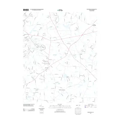
2013 Map of Rolesville
USGS Topo · Published 2013About this map
Rolesville serves as the central hub of this eastern Wake County landscape, where the established road network of Burlington Mills Rd and Mitchell Mill Rd connects small communities and agricultural crossroads. The terrain is defined by the Little River and a dense system of tributaries, including Smith Cr, Sanford Cr, and Fowlers Mill Cr. The map reveals a transition toward modern recreation and water management, featuring several significant bodies of water such as the Wake Forest Reservoir, Wakefield Pond Number Two, and Camp Durant Lake Number One. Smaller settlements like Barham, Lassiter, and Harris Crossroads remain distinct points in the landscape, reflecting the rural character of the region before the rapid suburban expansion of the 21st century. The concentration of lakes, from Poole Lake to Smiths Lake, suggests a geography deeply shaped by private dams and local hydrology.
Find a feature on this map
38 named features on this map. Tap any name to fly to it.
Don’t see what you’re looking for? This feature index may not catch every label — zoom into the map to look around manually.
Map Details
Editions of this 2013 Rolesville Map
This is the sole edition of this map. No revisions or reprints were ever made.
Other maps of this area

1943 · Raleigh
USGS Topo · 1:62,500

1943 · Creedmoor
USGS Topo · 1:62,500

1944 · Creedmoor
USGS Topo · 1:62,500

1951 · Raleigh
USGS Topo · 1:62,500

1953 · Raleigh
USGS Topo · 1:250,000

1953 · Greensboro
USGS Topo · 1:250,000

1954 · Greensboro
USGS Topo · 1:250,000

1954 · Raleigh
USGS Topo · 1:250,000

1962 · Greensboro
USGS Topo · 1:250,000

1966 · Greensboro
USGS Topo · 1:250,000