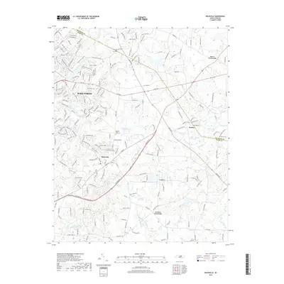
2019 Map of Rolesville
USGS Topo · Published 2019About this map
The town of Rolesville serves as a central hub in this northeastern Wake County landscape, where the growing residential street networks of Wake Forest begin to interface with traditional crossroads settlements. Established burial grounds like the Oak Grove Baptist Church Cem and Rolesville Baptist Church Cem provide essential anchor points for genealogical research in the area. The terrain is defined by a dense network of tributaries including Smith Creek, Austin Creek, and the Little River, which feed into numerous localized impoundments such as Brown Lake, Penny Hill Lake, and the Wake Forest Reservoir. To the south and east, the transition into more rural territory is marked by historic locations like Fowlers Crossroads, Lassiter, and Barham, where the land slopes toward the northern reaches of Falls Lake.
Find a feature on this map
203 named features on this map. Tap any name to fly to it.
Don’t see what you’re looking for? This feature index may not catch every label — zoom into the map to look around manually.
Map Details
Editions of this 2019 Rolesville Map
This is the sole edition of this map. No revisions or reprints were ever made.
Other maps of this area

1943 · Raleigh
USGS Topo · 1:62,500

1943 · Creedmoor
USGS Topo · 1:62,500

1944 · Creedmoor
USGS Topo · 1:62,500

1951 · Raleigh
USGS Topo · 1:62,500

1953 · Raleigh
USGS Topo · 1:250,000

1953 · Greensboro
USGS Topo · 1:250,000

1954 · Greensboro
USGS Topo · 1:250,000

1954 · Raleigh
USGS Topo · 1:250,000

1962 · Greensboro
USGS Topo · 1:250,000

1966 · Greensboro
USGS Topo · 1:250,000