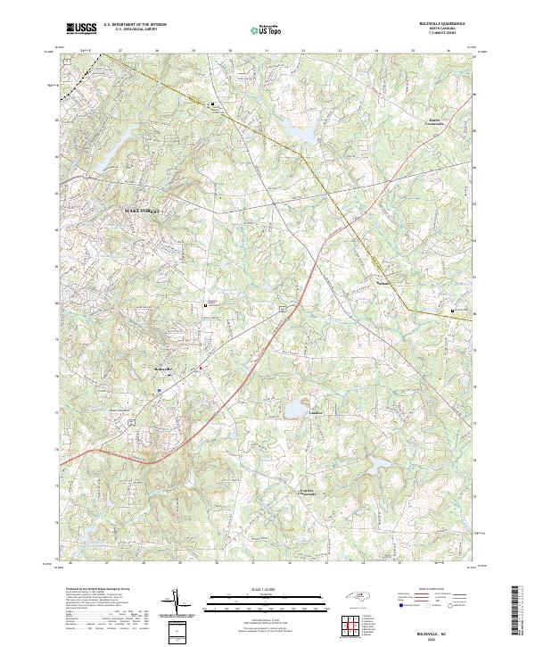
2022 Map of Rolesville
USGS Topo · Published 2022About this map
Wake Forest and Rolesville anchor this 2022 survey of northeast Wake County, showing a landscape defined by traditional crossroads and expanding residential networks. The boundary between Franklin and Wake counties cuts across the northern reaches, near the historic Oak Grove Baptist Church. The area’s water resources are prominently mapped, featuring the Little River and Falls Lake in the southeast, alongside numerous smaller bodies like Moores Pond, Sterling Lake, and Wakefield Pond Number Two.
Find a feature on this map
213 named features on this map. Tap any name to fly to it.
Don’t see what you’re looking for? This feature index may not catch every label — zoom into the map to look around manually.
Map Details
Editions of this 2022 Rolesville Map
This is the sole edition of this map. No revisions or reprints were ever made.
Other maps of this area

1943 · Raleigh
USGS Topo · 1:62,500

1943 · Creedmoor
USGS Topo · 1:62,500

1944 · Creedmoor
USGS Topo · 1:62,500

1951 · Raleigh
USGS Topo · 1:62,500

1953 · Raleigh
USGS Topo · 1:250,000

1953 · Greensboro
USGS Topo · 1:250,000

1954 · Greensboro
USGS Topo · 1:250,000

1954 · Raleigh
USGS Topo · 1:250,000

1962 · Greensboro
USGS Topo · 1:250,000

1966 · Greensboro
USGS Topo · 1:250,000