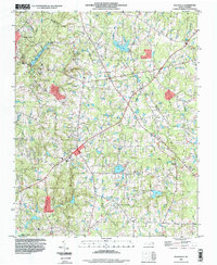
1993 Map of Rolesville
USGS Topo · Published 1999About this map
The town of Rolesville and its surrounding countryside are documented during a period of transition in the late twentieth century, showing a mix of established crossroad communities and expanding infrastructure. Waterways such as the Little River and Perry Creek define the drainage of the area, supporting landmarks like the Mitchell Millpond and Penny Hill Lake. Genealogical interest is found in the rural church congregations and burial grounds that dot the landscape, including Corinth United Ch, Beulah Ch, and the Mitchell Cem.
Find a feature on this map
32 named features on this map. Tap any name to fly to it.
Don’t see what you’re looking for? This feature index may not catch every label — zoom into the map to look around manually.
Map Details
Editions of this 1993 Rolesville Map
This is the sole edition of this map. No revisions or reprints were ever made.
Other maps of this area

1943 · Raleigh
USGS Topo · 1:62,500

1943 · Creedmoor
USGS Topo · 1:62,500

1944 · Creedmoor
USGS Topo · 1:62,500

1951 · Raleigh
USGS Topo · 1:62,500

1953 · Raleigh
USGS Topo · 1:250,000

1953 · Greensboro
USGS Topo · 1:250,000

1954 · Greensboro
USGS Topo · 1:250,000

1954 · Raleigh
USGS Topo · 1:250,000

1962 · Greensboro
USGS Topo · 1:250,000

1966 · Greensboro
USGS Topo · 1:250,000