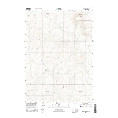
2015 Map of Rolling Pin Ranch
USGS Topo · Published 2015About this map
Rolling Pin Ranch anchors this high plains landscape of Campbell County, where the topography is defined by the drainages of Dry Willow Cr and Cottonwood Cr. The map illustrates a typical Western ranching environment, characterized by isolated water sources like Brown Reservoir and expansive terrain features such as Collins Draw and Cedar Canyon. The prominent elevation of North Middle Butte rises in the northeast corner, providing a significant landmark for the surrounding territory. Navigating through the area, Brown Rd provides the primary access route across the township lines. This 2015 survey documents the enduring physical character of the Wyoming rangeland, showing how local ranching operations and seasonal watercourses like Seventeenmile Cr shape the human and natural geography of the region.
Find a feature on this map
16 named features on this map. Tap any name to fly to it.
Don’t see what you’re looking for? This feature index may not catch every label — zoom into the map to look around manually.
Map Details
Editions of this 2015 Rolling Pin Ranch Map
This is the sole edition of this map. No revisions or reprints were ever made.
Other maps of this area

1953 · Dry Fork Ranch
USGS Topo · 1:24,000

1953 · Fort Reno SE
USGS Topo · 1:24,000

1953 · Savageton
USGS Topo · 1:24,000

1953 · South Butte
USGS Topo · 1:24,000

1953 · Rolling Pin Ranch
USGS Topo · 1:24,000

1953 · North Butte
USGS Topo · 1:24,000

1954 · Artesian Draw
USGS Topo · 1:24,000

1954 · Pine Tree
USGS Topo · 1:24,000

1954 · Taylor Ranch
USGS Topo · 1:24,000

1955 · Newcastle
USGS Topo · 1:250,000