
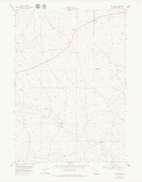
1954 Map of Pine Tree
USGS Topo · Published 1956About this map
The historical Bozeman Trail passes through this section of the Wyoming basin, as documented by the United States Atomic Energy Commission and the USGS in the mid-1950s. The landscape is defined by the ephemeral drainage systems of the South Prong Belle Fourche River and Ninemile Creek, where ranching operations such as the Van Gordon Ranch and Bozarth Ranch established themselves near reliable water sources like Pine Tree Spring. The tiny settlement of Pine Tree serves as a central point in this high plains environment, dominated by prominent landforms like Pine Tree Peak. Numerous windmills dot the terrain, signaling the vital importance of groundwater for the various homesteads and livestock operations like the Ninemile Ranch that navigate the draws and forks of Campbell County.
Find a feature on this map
19 named features on this map. Tap any name to fly to it.
Don’t see what you’re looking for? This feature index may not catch every label — zoom into the map to look around manually.
Map Details
Editions of this 1954 Pine Tree Map
2 editions found
Other maps of this area

1953 · South Butte
USGS Topo · 1:24,000

1953 · Rolling Pin Ranch
USGS Topo · 1:24,000

1954 · Artesian Draw
USGS Topo · 1:24,000

1955 · Newcastle
USGS Topo · 1:250,000

1958 · Newcastle
USGS Topo · 1:250,000

1959 · Coal Draw
USGS Topo · 1:62,500

1960 · Ross
USGS Topo · 1:62,500

1960 · Turnercrest
USGS Topo · 1:62,500

1974 · Reno Junction
USGS Topo · 1:100,000

1979 · Bill
USGS Topo · 1:100,000