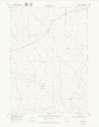
1954 Map of Pine Tree
USGS Topo · Published 1979About this map
Bozeman Trail cuts a historical path across this high-plains landscape, marked by its approximate location as it traverses the drainage of Ninemile Creek. In the mid-1950s, this portion of Campbell County remained a territory of sprawling livestock operations and remote outposts. Named family properties like the Van Gordon Ranch, Bozarth Ranch, and Ninemile Ranch are scattered across the terrain, illustrating the sparse settlement patterns typical of the region's ranching economy. The topography is defined by intricate drainage systems including Simmons Draw and Ninemile Draw, which feed into the South Fork Ninemile Creek. In the north, the headwaters of the Belle Fourche River and Bates Creek emerge near Pine Tree Peak, while the small settlement of Pine Tree and its nearby Pine Tree Spring serve as the primary landmarks in an area dominated by open range and wind-driven water infrastructure.
Find a feature on this map
17 named features on this map. Tap any name to fly to it.
Don’t see what you’re looking for? This feature index may not catch every label — zoom into the map to look around manually.
Map Details
Editions of this 1954 Pine Tree Map
2 editions found
Other maps of this area

1953 · South Butte
USGS Topo · 1:24,000

1953 · Rolling Pin Ranch
USGS Topo · 1:24,000

1954 · Artesian Draw
USGS Topo · 1:24,000

1954 · Pine Tree
USGS Topo · 1:24,000

1955 · Newcastle
USGS Topo · 1:250,000

1958 · Newcastle
USGS Topo · 1:250,000

1959 · Coal Draw
USGS Topo · 1:62,500

1960 · Ross
USGS Topo · 1:62,500

1960 · Turnercrest
USGS Topo · 1:62,500

1974 · Reno Junction
USGS Topo · 1:100,000