
1979 Map of Bill
USGS Topo · Published 1980About this map
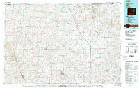
Highland Flats and the Cheyenne River Divide dominate this landscape in eastern Wyoming, where the drainage systems of the Cheyenne River and Antelope Creek have carved a dense network of draws and gulches. In 1979, the tiny settlement of Bill serves as a lone hub along the Burlington Northern line, which cuts north-south through the center of the sheet. The area’s economic character is defined by energy extraction and cattle ranching, evidenced by the Johnston Mine and a large Strip Mine located south of the Cheyenne River Divide. The map records a transition in land use, showing how industrial mining operations began to neighbor traditional landmarks like Badger Hill and Red Butte. Numerous named features like Stinking Water Creek and School Section Draw provide specific reference points for those studying the regional genealogy or the evolution of Converse and Campbell counties.
Find a feature on this map
58 named features on this map. Tap any name to fly to it.
Don’t see what you’re looking for? This feature index may not catch every label — zoom into the map to look around manually.
Map Details
Editions of this 1979 Bill Map
2 editions found
Other maps of this area

1949 · Campbell Hill
USGS Topo · 1:24,000

1949 · Sundquist Ranch
USGS Topo · 1:24,000

1949 · Gilbert Lake
USGS Topo · 1:24,000

1949 · Leuenberger Ranch
USGS Topo · 1:24,000

1949 · Glenrock NW
USGS Topo · 1:24,000

1949 · Hylton Ranch
USGS Topo · 1:24,000

1949 · Clausen Ranch
USGS Topo · 1:24,000

1950 · Campbell Hill
USGS Topo · 1:24,000

1950 · Clausen Ranch
USGS Topo · 1:24,000

1950 · Gilbert Lake
USGS Topo · 1:24,000