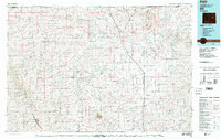
1979 Map of Bill
USGS Topo · Published 1980About this map
Bill serves as a central point of reference in this late-1970s survey of the high plains where Converse, Campbell, and Weston Counties meet. The landscape is defined by the Cheyenne River and its complex network of tributaries, including Antelope Creek, Lightning Creek, and Stinking Water Creek. These waterways carve through the Cheyenne River Divide and Highland Flats, illustrating the drainage patterns across the Pine Ridge area.
Find a feature on this map
26 named features on this map. Tap any name to fly to it.
Don’t see what you’re looking for? This feature index may not catch every label — zoom into the map to look around manually.
Map Details
Editions of this 1979 Bill Map
2 editions found

Other maps of this area

1949 · Campbell Hill
USGS Topo · 1:24,000

1949 · Sundquist Ranch
USGS Topo · 1:24,000

1949 · Gilbert Lake
USGS Topo · 1:24,000

1949 · Leuenberger Ranch
USGS Topo · 1:24,000

1949 · Glenrock NW
USGS Topo · 1:24,000

1949 · Hylton Ranch
USGS Topo · 1:24,000

1949 · Clausen Ranch
USGS Topo · 1:24,000

1950 · Campbell Hill
USGS Topo · 1:24,000

1950 · Clausen Ranch
USGS Topo · 1:24,000

1950 · Gilbert Lake
USGS Topo · 1:24,000