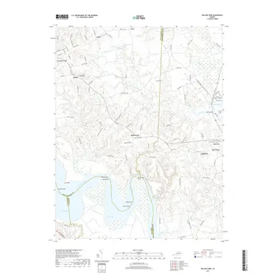
2019 Map of Rollins Fork
USGS Topo · Published 2019About this map
The Rappahannock River dictates the landscape of this Tidewater Virginia region, carving a sharp southern bend at Devils Elbow and Green Bay. Inland, the terrain is defined by a dense network of coastal creeks including Mattox Cr, Kings Mill Cr, and Jett's Creek. Small agricultural and crossroads settlements such as Rollins Fork, Oak Grove, and Shiloh are connected by a web of local roads like Bushrod Rd and Pomona Rd. For genealogists, the map identifies several significant burial grounds, including Shiloh Baptist Church Cem and Grace Cem. The northeastern corner transitions toward the Potomac watershed, featuring the Potomac Heritage National Scenic Trail near Mattox Bridge. This area, where King George Co, Westmoreland Co, and Essex Co converge, remains largely rural, dominated by wooded swamps like Cow Swamp and Boom Swamp.
Find a feature on this map
105 named features on this map. Tap any name to fly to it.
Don’t see what you’re looking for? This feature index may not catch every label — zoom into the map to look around manually.
Map Details
Editions of this 2019 Rollins Fork Map
This is the sole edition of this map. No revisions or reprints were ever made.
Other maps of this area

1889 · Fredericksburg
USGS Topo · 1:125,000

1892 · Fredericksburg
USGS Topo · 1:125,000

1892 · Montross
USGS Topo · 1:62,500

1894 · Wicomico
USGS Topo · 1:62,500

1894 · Fredericksburg
USGS Topo · 1:125,000

1895 · Wicomico
USGS Topo · 1:62,500

1895 · Nomini
USGS Topo · 1:125,000

1895 · Montross
USGS Topo · 1:62,500

1898 · Nomini
USGS Topo · 1:125,000

1902 · Wicomico
USGS Topo · 1:62,500