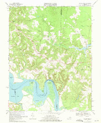
1968 Map of Rollins Fork
USGS Topo · Published 1971About this map
The Rappahannock River snakes through this 1968 landscape, defining the boundaries where King George, Essex, and Westmoreland counties meet. The river's influence is evident in the numerous maritime points and wharves, such as Greenlaw Wharf and Wilmont Wharf, which once served as vital links for trade and transport before the modernization of inland road networks. Further inland, the presence of the Colonial Beach Dragway indicates the region's mid-century shift toward recreational automotive culture.
Find a feature on this map
45 named features on this map. Tap any name to fly to it.
Don’t see what you’re looking for? This feature index may not catch every label — zoom into the map to look around manually.
Map Details
Editions of this 1968 Rollins Fork Map
This is the sole edition of this map. No revisions or reprints were ever made.
Other maps of this area

1889 · Fredericksburg
USGS Topo · 1:125,000

1892 · Fredericksburg
USGS Topo · 1:125,000

1892 · Montross
USGS Topo · 1:62,500

1894 · Wicomico
USGS Topo · 1:62,500

1894 · Fredericksburg
USGS Topo · 1:125,000

1895 · Wicomico
USGS Topo · 1:62,500

1895 · Nomini
USGS Topo · 1:125,000

1895 · Montross
USGS Topo · 1:62,500

1898 · Nomini
USGS Topo · 1:125,000

1902 · Wicomico
USGS Topo · 1:62,500