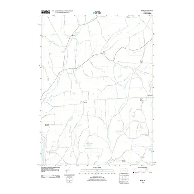
2010 Map of Rome
USGS Topo · Published 2010About this map
Wysox Creek and its many tributaries, including Bullard Creek and Taylers Creek, carve through this section of Bradford County, defining a landscape of high ridges and narrow valleys. The borough of Rome serves as a primary local hub, while smaller named settlements like Allis Hollow, Mercur, and Herrickville are scattered across the uplands. This area is characterized by a dense network of country roads, many bearing family names that reflect generations of local residence, such as Towner Hill Rd, Jim Diamond Hl, and Westbrook Rd.
Find a feature on this map
94 named features on this map. Tap any name to fly to it.
Don’t see what you’re looking for? This feature index may not catch every label — zoom into the map to look around manually.
Map Details
Editions of this 2010 Rome Map
This is the sole edition of this map. No revisions or reprints were ever made.
Other maps of this area

1923 · Towanda
USGS Topo · 1:62,500

1926 · Towanda
USGS Topo · 1:62,500

1943 · Towanda
USGS Topo · 1:62,500

1943 · Monroeton
USGS Topo · 1:62,500

1943 · Le Raysville
USGS Topo · 1:62,500

1945 · Le Raysville
USGS Topo · 1:62,500

1945 · Meshoppen
USGS Topo · 1:62,500

1945 · Laceyville
USGS Topo · 1:24,000
1947 · Laceyville
USGS Topo · 1:24,000

1954 · Williamsport
USGS Topo · 1:250,000