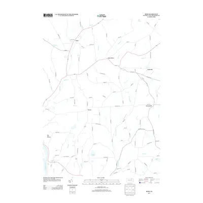
2013 Map of Rome
USGS Topo · Published 2013About this map
Rome serves as a focal point in this portion of Bradford County, where the northern waters of Wysox Cr and Parks Cr converge. The landscape is defined by a series of narrow valleys and high ridges, including Red Rock Mountain and South Hill, which shaped the early settlement patterns of the region. Small communities such as Allis Hollow and Mercur are linked by a network of winding roads like Allis Hollow Rd and Taylor Hill Rd, reflecting the rural agricultural character of the early 21st century. Along the western edge, the Susquehanna River passes near Claverack Pond, while numerous interior waterways like Rummerfield Cr and Johnson Cr continue to drain the upland plateaus. This survey captures a mix of glacial ponds, including Tamarack Pond and Totem Lake, alongside established crossroads that have served local families for generations.
Find a feature on this map
100 named features on this map. Tap any name to fly to it.
Don’t see what you’re looking for? This feature index may not catch every label — zoom into the map to look around manually.
Map Details
Editions of this 2013 Rome Map
This is the sole edition of this map. No revisions or reprints were ever made.
Other maps of this area

1923 · Towanda
USGS Topo · 1:62,500

1926 · Towanda
USGS Topo · 1:62,500

1943 · Towanda
USGS Topo · 1:62,500

1943 · Monroeton
USGS Topo · 1:62,500

1943 · Le Raysville
USGS Topo · 1:62,500

1945 · Le Raysville
USGS Topo · 1:62,500

1945 · Meshoppen
USGS Topo · 1:62,500

1945 · Laceyville
USGS Topo · 1:24,000
1947 · Laceyville
USGS Topo · 1:24,000

1954 · Williamsport
USGS Topo · 1:250,000