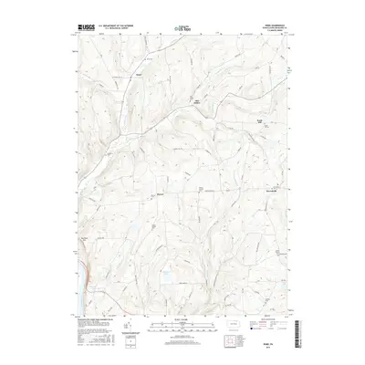
2016 Map of Rome
USGS Topo · Published 2016About this map
The borough of Rome and the surrounding townships in Bradford County are defined by a network of creeks and high ridges, where small settlements like Allis Hollow and Herrickville anchor the local geography. The landscape is characterized by its numerous family and community burial grounds, including the Ireland Catholic Cem and Keene Summit Cem, which reflect the generations of residents who established farms along the valley floors. Drainage patterns are dominated by Wysox Creek and Rummerfield Cr, while the southwestern corner of the sheet is marked by the presence of the Susquehanna River and the rise of Red Rock Mtn. To the south, Tamarack Pond and Totem Lake provide significant water features amidst a terrain of timbered slopes and rural roads like Harmony Hill Rd.
Find a feature on this map
105 named features on this map. Tap any name to fly to it.
Don’t see what you’re looking for? This feature index may not catch every label — zoom into the map to look around manually.
Map Details
Editions of this 2016 Rome Map
This is the sole edition of this map. No revisions or reprints were ever made.
Other maps of this area

1923 · Towanda
USGS Topo · 1:62,500

1926 · Towanda
USGS Topo · 1:62,500

1943 · Towanda
USGS Topo · 1:62,500

1943 · Monroeton
USGS Topo · 1:62,500

1943 · Le Raysville
USGS Topo · 1:62,500

1945 · Le Raysville
USGS Topo · 1:62,500

1945 · Meshoppen
USGS Topo · 1:62,500

1945 · Laceyville
USGS Topo · 1:24,000
1947 · Laceyville
USGS Topo · 1:24,000

1954 · Williamsport
USGS Topo · 1:250,000