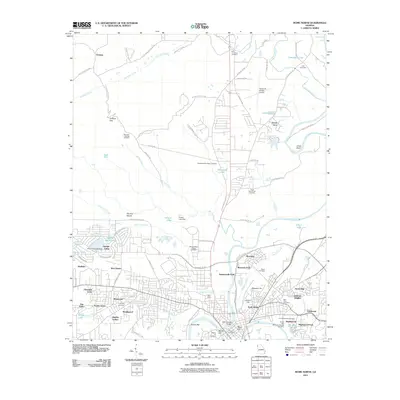
2011 Map of Rome North
USGS Topo · Published 2011About this map
The Oostanaula River flows south to join the Etowah River and form the Coosa River, anchoring the urban and industrial development of this Georgia community. The map details a period of suburban expansion into the surrounding ridges, showing established neighborhoods such as West Rome, North Rome, and Summerville Park. Beyond the city center, the landscape is defined by institutions and infrastructure, including the Berry College Chapel Cemetery and the Richard B Russell Airport. Numerous family and community burial grounds, such as the Tate Cemetery and Myrtle Hill Cemetery, are meticulously documented. The inclusion of sites like the Coosa Valley Fairgrounds and the Fifth Avenue Bridge highlights the civic landmarks that shape the daily life of Floyd County residents in the early 21st century.
Find a feature on this map
99 named features on this map. Tap any name to fly to it.
Don’t see what you’re looking for? This feature index may not catch every label — zoom into the map to look around manually.
Map Details
Editions of this 2011 Rome North Map
This is the sole edition of this map. No revisions or reprints were ever made.
Other maps of this area

1886 · Rome
USGS Topo · 1:125,000

1898 · Rome
USGS Topo · 1:125,000

1899 · Rome
USGS Topo · 1:125,000

1904 · Rome
USGS Topo · 1:125,000

1955 · Rome
USGS Topo · 1:250,000

1958 · Rome
USGS Topo · 1:250,000

1961 · Rome
USGS Topo · 1:250,000

1963 · Rome
USGS Topo · 1:250,000
1967 · Summerville
USGS Topo · 1:24,000
1967 · Rock Mountain
USGS Topo · 1:24,000